
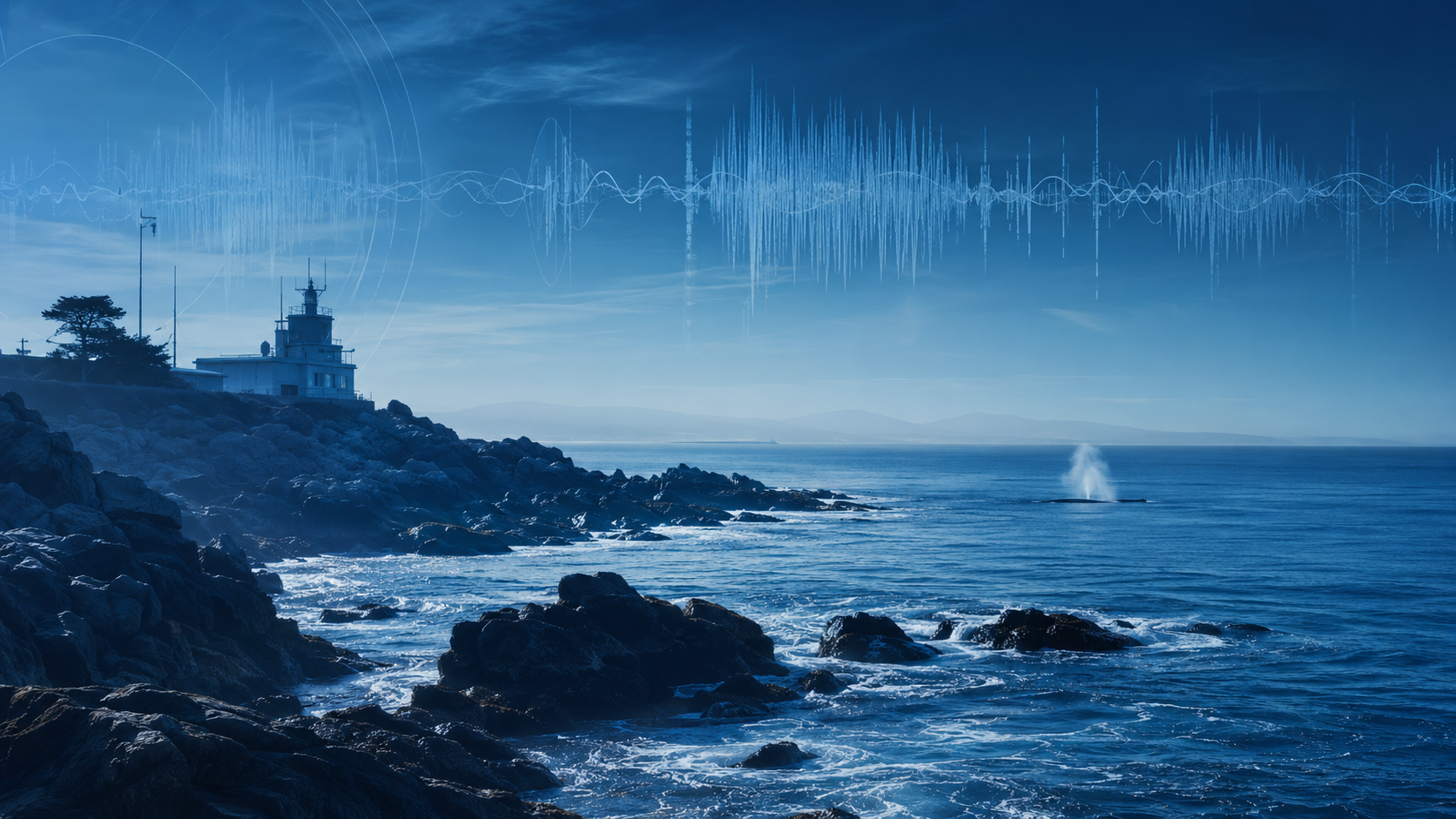
Whales and vessels share the same water
A vessel can follow every rule and still never see the whale in time. Watch the footage.
LOADING FEED...
This is the blind spot Leviathan is built to close.
Fusing physical sensing
with software intelligence.
LeviathanOS turns ocean signals into usable intelligence. Ocean observatories create the persistent sensing layer that makes the intelligence possible.
LeviathanOS
A working operating layer for detection, context, human review, and report-ready evidence. Fuses raw sensor signals with AIS vessel tracks, acoustics, and environmental telemetry.
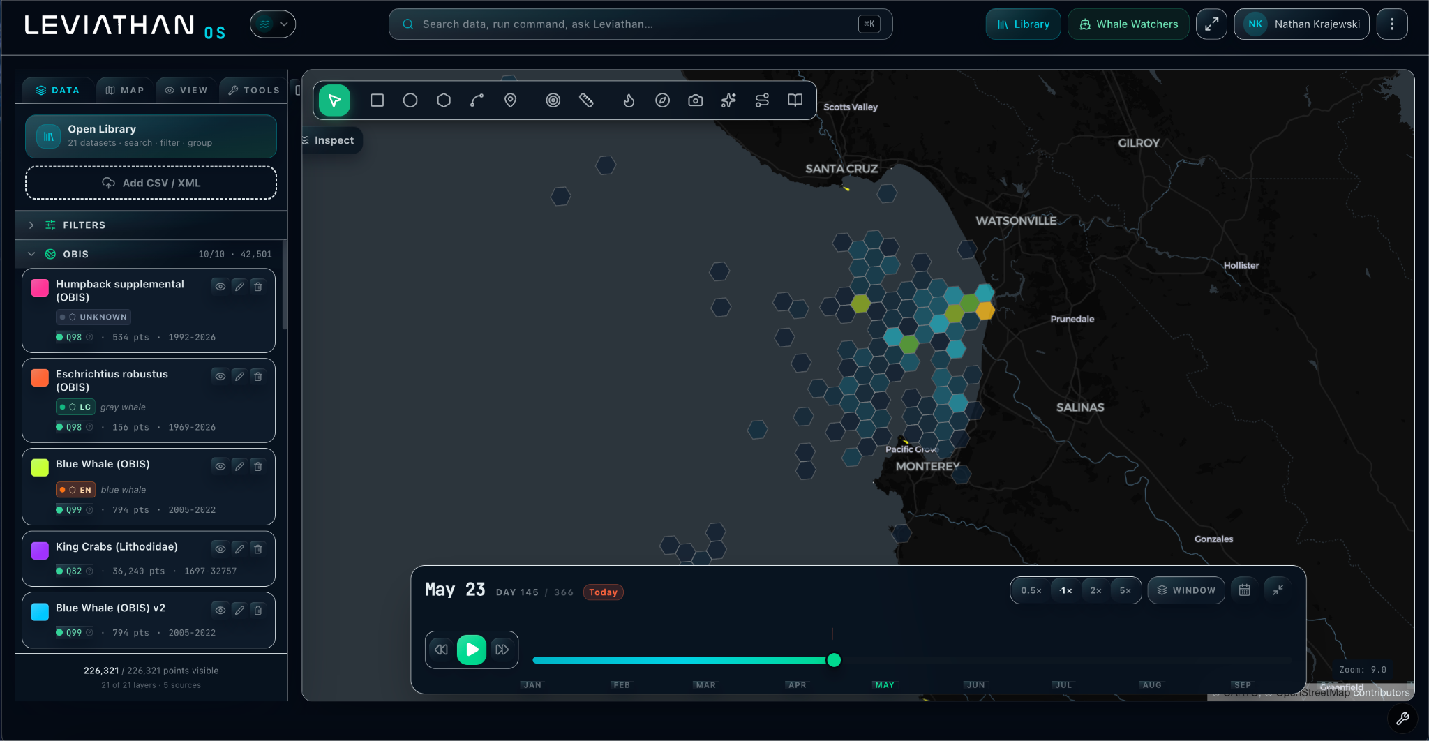
Browser-first workspace connects visual, acoustic, and vessel tracks into one evidence-based view.
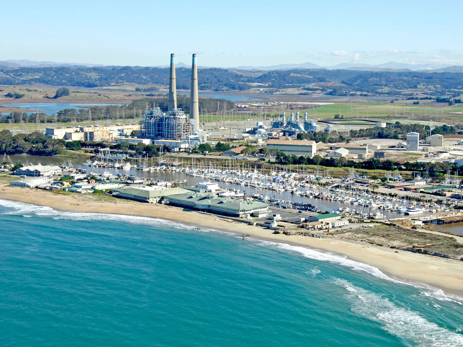
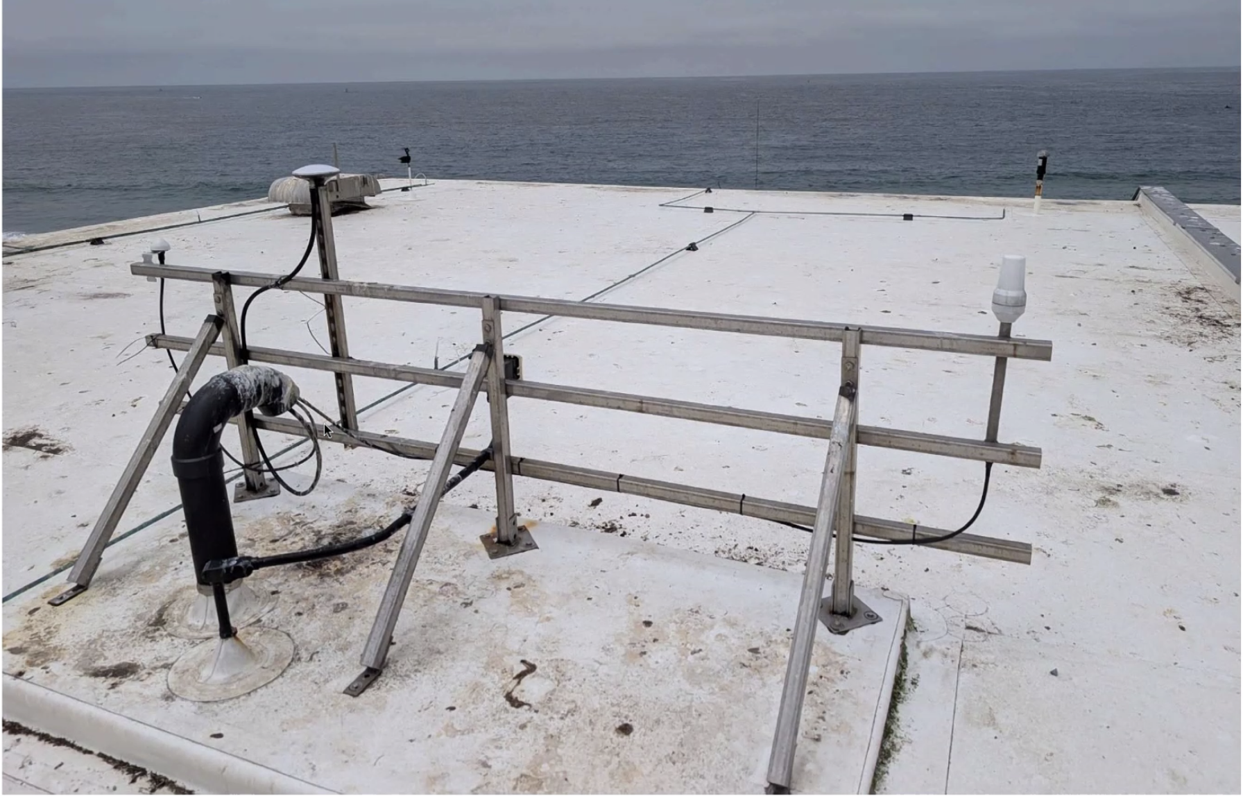
Ocean Observatories
Rugged shore-based stations with co-aligned visual and thermal imaging arrays. Solar-powered and custom-built for continuous coastal observation through fog, glare, and darkness.
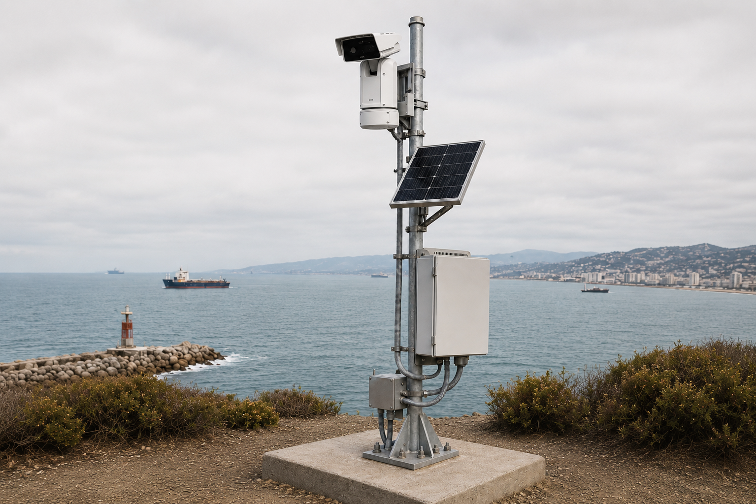
First station installations staging validation pathways to capture occurrence data near Monterey Bay.
Partner Network
Leviathan is integrated with technical, scientific, and operational network partners to build a reliable and validated ocean intelligence commons.


Coastal Intelligence as a Service
Persistent coastal monitoring, validated telemetry, and actionable reporting, structured as a recurring, managed subscription.
Observe
Ocean Observatories
Observe
Shore-based ocean observatories collect persistent coastal signals.
A first validation pathway
in Monterey Bay
LeviathanOS is being shaped around a simple scientific question: when a whale is observed from shore, what evidence supports that detection?
MBARI Acoustic-Visual Validation Map
Technical & Scientific Network
Collaborative data integration, staging pathways, and technical memberships shaping real-time marine intelligence.
Deployment pathway
Leviathan is moving from private beta software into first shore-based observation deployments with scientific validation partners.
Private Beta
LeviathanOS is active and being shaped with researcher/operator feedback.
First Ocean Observatory
Initial station planning focuses on high-value coastal monitoring sites.
Validated Intelligence
Detection outputs are reviewed, calibrated, and packaged into usable reports.
Observe the seas
Coastal Intelligence as a ServiceLeviathan starts with whales because they are the highest-signal, highest-urgency coastal intelligence use case. Join us in building a flourishing, scientifically traceable ocean.
Nate Krajewski / Founder & Engineer